
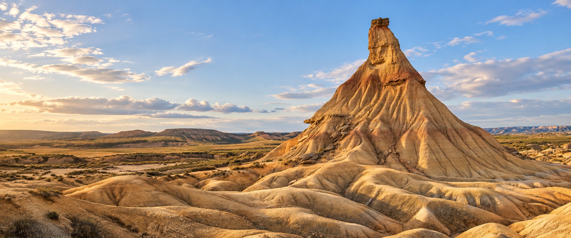
An otherworldly landscape · Navarre
The Bardenas Reales desert:
plan your visit
What to see, how to explore and everything you need to plan your visit.
Route and notice map: what is closed today and which entrance to use
Choose how you are travelling and the village you set off from: the map draws the possible routes and marks them closed if a park notice shuts them that day and at that time.
The automatic check of park notices has not worked for more than three days: new hunting drives or closures may have been announced. Check the official page before you go.
1How are you getting there?
2
3Which day?
Pick a time
Only on roads and tracks signposted for motor vehicles, at 40 km/h at most and in groups of fewer than five vehicles. Never leave the track.
Only on tracks and dirt roads, ideally the signposted mountain-bike circuits. Footpaths are not for bikes, and walkers have priority.
On tracks, dirt roads and footpaths. Climbing the cabezos (buttes) is forbidden.
The park does not publish which tracks suit motorhomes: ask at the information centre. Motorhome guide.
Possible routes
The Polígono road to the information centre, then the track to the Castildetierra car park along the official driving route. The easiest for a first visit.
The park’s official driving route (Blanca circuit from Aguilares): the track around the firing range, back via Castildetierra. The military interior is always off limits.
The park’s official driving route (Blanca circuit from El Paso): from El Paso, on the track down from Carcastillo, to the Perimetral; round the firing range via Castildetierra and back to El Paso. Visit Navarra advises against sports cars and minis on this access. The point for the El Paso entrance is approximate.
Main road between Tudela and Ejea: it crosses the Bardena Negra without using any track. The Negra tracks open to vehicles (Portimayor, Sancho Abarca) are listed separately, by car.
The park’s official driving route in the north-west of the Bardena Blanca: from the N-121 to El Ferial reservoir and along the track towards El Yugo. Away from Castildetierra and quieter.
The park’s official driving route in the Bardena Negra: it leaves Fustiñana, passes Portimayor and reaches the NA-125, which takes you back to Tudela or on to Ejea.
The park’s official driving route in the east of the Bardena Negra: from the NA-125 (Ejea road) towards the Sancho Abarca sanctuary.
The park’s official walking route: 1 km, almost flat, from the Castildetierra car park, reached by car from Arguedas. By car to the car park (5.9 km)
The park’s official walking route: 4.1 km there and back with about 290 m of climbing (Visit Navarra gives 5–6 km and 1 h 30–2 h). The access track from the NA-126 is not a main track: follow the signs. Approximate access: the last stretch is on a track; follow the signs (4 km)
200 m of climbing. Start: El Paso, by the Shepherd’s Monument. GPX track published by the park. Route sheet and track
60 m of climbing. Start: El Ferial dam. GPX track published by the park. Route sheet and track
300 m of climbing. Start: El Paso, by the Shepherd’s Monument. GPX track published by the park. Route sheet and track
120 m of climbing. Start: Arguedas information centre, via the Aguilares pass. GPX track published by the park. Route sheet and track
190 m of climbing. Start: Hermitage of Nuestra Señora del Yugo (Arguedas). GPX track published by the park. Route sheet and track
240 m of climbing. Start: NA-125 km 17.3 (Tudela–Ejea). GPX track published by the park. Route sheet and track
330 m of climbing. Start: NA-125 km 17.3, heading south. GPX track published by the park. Route sheet and track
330 m of climbing. Start: NA-125 km 17.3; out and back. GPX track published by the park. Route sheet and track
450 m of climbing. Start: NA-126 km 22 (Tudela–Tauste). GPX track published by the park. Route sheet and track
520 m of climbing. Start: El Paso in the north; finish at NA-126 km 22. GPX track published by the park. Route sheet and track
Key
- Possible route
- Way from the village
- Route closed that day
- Closed
- Event: possible delays
- Motorhome aire (in the village, outside the park)
- Castildetierra car park
- Driving stretch
- Motorhome stretch
- Cycling stretch
- By car to the car park
- Walking stretch
More map symbols
- Roads and main tracks according to OpenStreetMap (not the authorised network: signs prevail)
- Roads, tracks and dirt roads according to OpenStreetMap (bikes only on authorised ones: signs prevail)
- Roads, tracks, dirt roads and footpaths according to OpenStreetMap
- Other tracks: by car only where a sign allows it
- Footpaths: walkers only
- Open with restrictions
- Firing range: no entry at any time
- Park boundary
- Park entrance
- Information centre
- Cabezo (butte)
- Village
Where to sleep without a fine
Overnight stays, camping and putting out an awning, table or chairs are forbidden across the whole park, including the Castildetierra car park. Sleep at a motorhome aire in the villages:
Arguedas · Paseo del BordónClosest to your entrance
Council aire: 9 pitches, 48 h maximum, free parking and a €2 service token. Handy for the information centre and the Bardena Blanca.
Fustiñana · Calle Santa Lucía 53Closest to your entrance
Council rest area in the village: water, a dump point and free electricity tokens. Handy for the South Gate and the Bardena Negra.
Cabanillas · Calle San Isidro 2Closest to your entrance
Council aire on the way to Tudela, with water and a dump point, 48 h maximum. It is not a park entrance.
Arguedas also has a private paid aire on Calle Eras Bajas (€10 a night according to Park4night). Pitches, services and reviews: motorhome guide.
Tracks and rain
There is no AEMET forecast for that day. If it has rained, ask before going in.
The park advises against going in if the rain is persistent or has damaged the tracks. This is a forecast for Arguedas, not the actual state of the track; the NA-125 is a paved road. AEMET · Information centre: +34 948 830 308
Parking at Castildetierra
The route from Arguedas ends at the car park next to Castildetierra (P on the map). Park only where signposted, never on the track or at the foot of the cabezo.
The Comunidad de Bardenas has announced a paid car park there with advance booking (70 cars and 5 coaches) for 2026. Checked on 28/10/2026: its website does not yet publish the opening date, the price or whether motorhomes are allowed. Plaza Nueva article (30/12/2025, in Spanish)
Notices for that day2
Cabezo de Cortinillas
Access trail closed due to risk of rockfalls. No reopening date given.
- By car: Not affected
- By bike: Not affected
- On foot: Closed
At another time
Full notice
Trail closed: the access trail to Cabezo de Cortinillas is closed due to risk of rockfalls. No reopening date given; follow the signs and instructions.
Perimetral – El Paso track
Closed to traffic: a bridge was damaged by the rains and repairs are under way. No reopening date given.
- By car: Closed
- By bike: Closed
- On foot: Closed
At another time
Full notice
Track closed to traffic: the track from the Perimetral towards El Paso is closed due to torrential rain damage to one of its bridges and repair works. No reopening date given; follow the signage.
El Plano – Blanca Alta SPA
Reopened on foot via PORN tracks to La Ralla, Rallón, Pisquerra, La Gorra and Balsa de Zapata; no bikes, horses or motor vehicles.
- By car: Closed
- By bike: Closed
- On foot: Open
approximate area
At another time
Full notice
El Plano – Blanca Alta SPA reopened on foot: access via PORN-approved tracks to La Ralla, Rallón, Pisquerra, La Gorra and Balsa de Zapata. Other paths stay closed; no mountain bikes, horses or motor vehicles.
No closures or events marked on the map for this day, as of the last check. That does not guarantee everything is open.
Notices we cannot place on the map
- Blue Rally Bardenas 2026: the notice does not publish the route. Official notice
- Big-game hunting drive: zone LANDA1, NEGRA1A, NEGRA1B, RF02A is not drawn on our map. Official notice
Official notices checked on · About the map data
Routes inside the park follow the official GPX tracks the park publishes in its app; the way from each village is the fastest according to OpenStreetMap. Signs always prevail. Our own map. The park boundary, firing range, roads, tracks, footpaths and cabezos come from OpenStreetMap; the hunting zones and the bird area are approximate. The driving, walking and mountain-bike routes follow the park’s official GPX tracks; beyond them, the map does not draw the authorised network. It updates itself from the official notices, placed by the place names they mention. Signs on site and the official notice always prevail. All official notices.
Map data © OpenStreetMap contributors (ODbL), via Overture Maps Foundation. Navarre boundary: © IGN (CC BY 4.0). Villages: GeoNames (CC BY 4.0).
This week in the park
The essentials from the official notices. Times, zones and links for each one are on the notices page.
The automatic check of park notices has not worked for more than three days: new hunting drives or closures may have been announced. Check the official page before you go.
- 22, 23, 29 and 30 OctBlue Rally Bardenas 2026Access affected
- 31 OctBig-game hunting driveTracks closed
- ongoingCabezo de CortinillasClosed
- ongoingPerimetral – El Paso trackClosed
- ongoingEl Plano – Blanca Alta SPALimited access
No notices published right now.
Weather in Arguedas
AEMET forecast for the municipality of Arguedas, next to the Bardena Blanca.
We have not been able to update the forecast in the last few days.
Fri 30
22° 8°
Clear
No rain or wind- Rain 0 %
- Wind calm
Sat 31
18° 7°
Cloudy
No rain or wind- Rain 0 %
- Wind NW 5 km/h
Sun 1
19° 6°
Mostly clear
Gusty wind- Rain 0 %
- Wind NW 30 km/h, gusts 50
Mon 2
19° 8°
Mostly clear
Gusty wind- Rain 0 %
- Wind NW 25 km/h, gusts 50
Tue 3
14° 5°
Partly cloudy
Gusty wind- Rain 10 %
- Wind NW 25 km/h, gusts 50
Wed 4
12° 3°
Cloudy with rain
Rain likely- Rain 60 %
- Wind calm
Independent guide · Official sources linked
Your Bardenas trip, from start to finish.
Discover the landscapes, find a plan that suits you and get the practical details sorted before you go.
About this guide01The landscape
Places that will leave you speechless
Unique landscapes you should not miss.


02Your getaway
A getaway made for you
Ideas and plans to enjoy the Bardenas, whatever your trip.


What to see nearby if you have a spare day, or if the park closes
Illustrative getaway scenes.
03At your pace
Your next adventure starts here
The best ways to experience the Bardenas.


Illustrative activity scenes.

05Your starting point
Find your way in
19 towns surround the Bardenas. Three make good gateways.

Choose your starting point
and plan the route.
Arguedas, Tudela or Fustiñana are good starting points to discover the Bardenas.
How to get there06The essentials
Ready for your visit
Practical information so you can simply enjoy it.
Keep to authorised paths and routes. Stay overnight outside the park and check official notices before setting off.
Read the official rules07Your questions
Your questions answered
Everything you need to know to plan your visit.
How many hours do I need?
The documented first-visit car block is Visit Navarra’s: about 25 km and 2 hours from Arguedas, plus the centre and stops. First visit · two days.
Can I go in a normal car or do I need a 4x4?
Visit Navarra advises against sports cars and minis. The park allows motor vehicles only on authorised tracks, at 40 km/h. A 4x4 does not open a closed track. By car.
Is it a good trip with children?
Yes if the plan is short, with water and the authorised walk (Castildetierra, 1.15 km, if it is open). With children.
Where do I stay?
Outside the park. Arguedas for the Blanca, Fustiñana for the South Gate. This is not a hotel list. Where to stay. This project’s house: El Balcón del Moncayo.
